A Rarely Seen Panorama of Fredericksburg, and the Pictorial Legacy of Henri Lovie


from: Harrison

Note: for magnification of a picture or map below, click on it, then select “Open in New Tab” (phone) or “Open Image in New Tab” (computer).

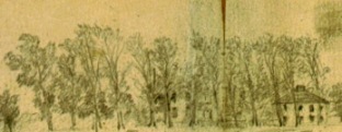
Among the contemporary drawings of the December 1862 Battle of Fredericksburg, I find a little known panorama by artist-eyewitness Henri Lovie easily the most ambitious. With Battle of Fredericksburg, Dec. 13, 1862, he depicted in a single sketch the fighting at both ends of the battlefield that day–principal combat sites separated by four miles at the extremes. Lovie’s drawing measures four and one-half inches in height and nearly five feet in length. Beyond its own artistic power, it served as the main reference for a pair of grand-finale pictures in a striking sequence of eight wood engravings, or woodcuts, of the Fredericksburg campaign. Frank Leslie’s Illustrated Newspaper published the eight over the course of five issues and four weeks, basing the other six woodcuts mainly on Lovie’s sketches as well and even incorporating the pictures into its editorial critique of the campaign. I only recently noticed his December 13 drawing in the digitized collections of the New York Public Library. The Library’s link to it and the means to magnify or download a high-resolution copy are here.

The right end of the sketch includes the only known—to me, at least—eyewitness drawing that looks northwest at the fighting outside Fredericksburg and in front of Marye’s Heights. For orientation, I made preliminary, estimated identifications of selected landmarks:

Detail from Henri Lovie, Battle of Fredericksburg, Dec. 13, 1862, The Miriam and Ira D. Wallach Division of Art, Prints and Photographs: Print Collection, The New York Public Library. Annotation and color contrast by Noel G. Harrison.

(I share this portion of the sketch, and those below, to advance the educational purpose of this blog, and in accordance with the New York Public Library’s posted belief that the item is in the public domain under the laws of the United States.)

The left end offers what I believe is the only eyewitness sketch of the fighting in the opposite, southern zone of the battlefield that includes, albeit faintly, the Confederate artillery defending Prospect Hill as well as many of the Federals confronting the hill from east of the Richmond Stage Road:

Detail of Henri Lovie, Battle of Fredericksburg, Dec. 13, 1862, The Miriam and Ira D. Wallach Division of Art, Prints and Photographs: Print Collection, The New York Public Library. Annotation and color contrast by Noel G. Harrison.

Lovie (1829-1875, born in Berlin, Prussia) sketched from a vantage point on the edge of the bluffs on the Stafford County (east) side of the Rappahannock River and near the pontoon bridges at Franklin’s Crossing:

Detail of Fredericksburg and Spotsylvania National Military Park, Battle of Fredericksburg December 13, 1862 2:00-3:00 P.M., Map 4 of 5, Historical research by Frank A. O’Reilly, Illustrated by John Dove, Revised and produced by Steve Stanley (2001). Courtesy Fredericksburg and Spotsylvania National Military Park. Directional arrow at upper left; north is toward right on map. Lovie-related annotation by Noel G. Harrison.

Continue reading

The War of 1812 in the Fredericksburg Area: Backstory and the First Local Campaign


from: Harrison

Imagine troop concentrations in southern Stafford County and on the heights just west of Fredericksburg…and military movements from one towards the other. Easy to do? Yes, but I have in mind such scenes from the eighteen-teens, not the eighteen-sixties. Let’s consider another American war with a single- or multiple centennial this year. This post, part 1 of a short series, recounts the first sequence of operations that occurred in Fredericksburg and Stafford during the War of 1812, specifically events in the summer of 1813.  (Limited space necessitates omitting the better-known operations that took place further afield that summer, along the Northern Neck.)

Besides surveying some of the local contours of the conflict during its bicentennial, my interest lies with an intriguing aspect of the history of the Fredericksburg area, an aspect that’s obscured by the drama and duration of the Civil War: the nature of military events here, whether limited or extensive, has shifted back and forth between those involving local or regional combatants, and those featuring overseas interests or forces.

Artist Tom W. Freeman, SM&S Naval Prints, recently created the only known rendering of a Fredericksburg landscape during the War of 1812 era. Published here for the first time through the courtesy of business- and civic leader Joe Wilson, who commissioned the painting for his family’s collection in 2006, “Fredericksburg Landing” shows the town’s Rappahannock wharves in 1816. The painting illustrates vividly the local river connections—Potomac as well as Rappahannock—that brought vulnerability as well as economic opportunity. Permission courtesy Joe Wilson, copy photo courtesy Tom W. Freeman; image not for re-use or reproduction.

Artist Tom W. Freeman, SM&S Naval Prints, recently created the only known rendering of a Fredericksburg landscape during the War of 1812 era. Published here for the first time through the courtesy of business- and civic leader Joe Wilson, who commissioned the painting for his family’s collection in 2006, “Fredericksburg Landing” shows the town’s Rappahannock wharves in 1816. Local river connections—Potomac as well as Rappahannock—brought vulnerability as well as economic opportunity. Permission courtesy Joe Wilson, copy photo courtesy Tom W. Freeman; image not for re-use or reproduction.

The local-regional category of military history includes everything from a battle near Potomac Creek between resident Potowomekes and Indian outsiders in the 1610’s to the launching of a raid into Maryland by the Stafford Troop of Horse in 1675 to the numerous clashes of the Civil War in 1861-1865.  Events in which overseas interests or forces played a key role include the Mannahoc-English skirmish at the Rappahannock falls in 1608—resulting from an effort by the Virginia Company of London to find gold, silver, and trade routes to the Pacific—to a brief but contested British amphibious landing on Stafford County’s Widewater Peninsula in 1775.  This varied, shifting nature of “war” and “the enemy” is even more pronounced when we also consider the fears (however unfounded those proved) of overseas invaders operating in the Fredericksburg area, particularly Spanish landing-parties in 1898 and Axis saboteurs and aircraft during World War Two.

In the era of the French Revolution and through the rise of Napoleon, Europe’s wars roiled the people of the central Rappahannock valley despite the vast distances intervening. An early Fredericksburg historian, who doubtless had neighbors and acquaintances possessing memories of the Napoleonic period, wrote that “bitter feeling” over foreign policy and other political issues increased locally through the 1790’s, “even boiling over at times.” In 1796, Fredericksburgers learned that one of their fellow townsmen, William M’Coy, was among the American sailors impressed by the British Navy. In the Caribbean, the French seized in 1795 the Fredericksburg-based sloop Martha, and in 1797 the Tappahannock-based sloop Prudent, also voyaging from Fredericksburg and also carrying barrels of flour.

Slide2

Conjectural sketch (inset) of Fredericksburg’s first Market House/Town Hall, constructed c. 1757 and fronting on Caroline Street. This building hosted public meetings about the coming and fighting of no less than three wars between 1774 and 1812. It was demolished in 1813 and replaced with the current Market House/Town Hall (situated on the opposite side of the same block). The alley in the modern photo passes through what was once the center of the c. 1757 building. Modern photo courtesy Greg Chapman; sketch courtesy Fredericksburg Area Museum and Cultural Center.

Continue reading

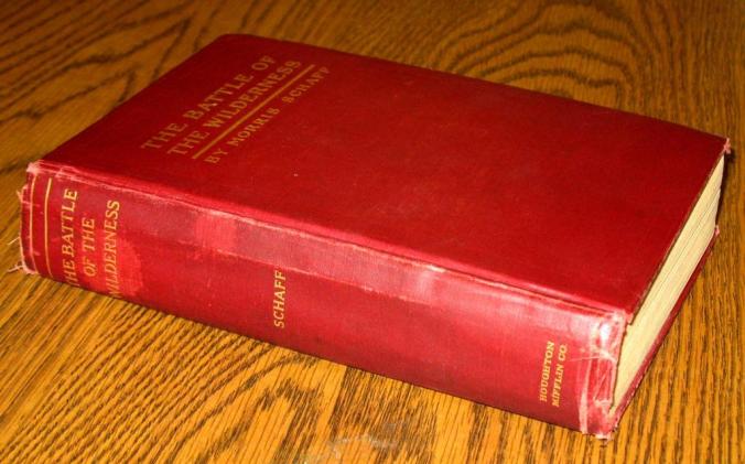
Morris Schaff’s Wilderness, pt. 2: Spirits, Ghosts, and Talking Plants on the Battlefield


from: Harrison

My previous article of this miniseries introduced Union veteran Morris Schaff and his authoring of The Battle of the Wilderness, the first book on its subject. That article also began considering why Schaff’s goal of writing careful, conventional battle history remains virtually unknown today. When we compare his ambition to the same ambition embodied in John Bigelow’s book, The Campaign of Chancellorsville, published the same year, 1910, and destined to garner wide respect for evaluating the tactics and grand tactics of another local battle, the obscurity that befell Schaff’s project is all the more striking.

The article below explores the principal, ironic impediment to Schaff’s hope of being remembered for his conventional history: his book’s parallel, unconventional goal of understanding the battle and its participants as affected by activist spirits and ghosts, and intelligent, even compassionate, vegetation. As I noted earlier, a critic who reviewed Schaff’s book in 1911 marveled at an author “who, while framing a military treatise, can at the same time make it a new ‘Alice in Wonderland.’” A second reviewer, commenting on his book in The Dial in 1912, worried that the pairing of very different interpretive methods was “a stumbling-block” for many readers. The Dial critic went on to relate the response of a “distinguished fellow-soldier” to Schaff: “When you get done with your poetry and get down to history you will write a valuable book.”

Marginalia and an inscription in this copy of Morris Schaff’s book indicate that 49-year-old Franklin J. Roth read it over the course of three weeks in the fall of 1912. A 1920’s newspaper article described Roth as president of the Harrisburg, Pennsylvania School Board and “a collector of old documents and historical data.” Fredericksburg and Spotsylvania National Military Park library.

Marginalia and an inscription in this copy of Morris Schaff’s book indicate that 49-year-old Franklin J. Roth read it over the course of three weeks in the fall of 1912. A 1920’s newspaper article described Roth as president of the Harrisburg, Pennsylvania School Board and “a collector of old documents and historical data.” Fredericksburg and Spotsylvania National Military Park library.

If Schaff’s diversions into the supernatural had been less prominent, readers might have understood those as efforts to enliven the book with analogy and allegory, or to achieve other purposes common among writers of his era. For instance, some of Schaff’s passages reflect the view, shared by many of the Civil War generation, that battlefield death could bring nobility, individual peace in the Christian afterlife, and North-South reconciliation. His book at one point has the allegory of Death encountering the mortally wounded Lieutenant Colonel Alford Chapman of the 57th New York Infantry; likely at no other place in the Wilderness had Death “met more steady eyes than those of this dying, family-remembering young man.” At another juncture, the spirits of dead soldiers, from both armies, rise “above the tree tops…a great flight of them towards Heaven’s gate…. [T]wo by two they lock arms like college boys and pass in together; and so it may be for all of us at last.”

Yet Schaff’s supernatural characters appear even more dramatically, across some 25 per cent of his book, in repeated interventions that alter battle outcomes and soldier experiences. For starters, there’s “The Spirit of the Wilderness,” which in turn has the capacity to conjure The Spirit of Slavery. Schaff at several points describes The Spirit of Slavery as a single being and at another as “a resurrected procession of dim faces” moving “in “ghostly silence.” The Spirit of the Wilderness is determined to punish the Confederacy for the miseries suffered in the same forest a century earlier by those people while alive and enslaved on Alexander Spottswood’s vast local landholdings (and more generally by all slaves since then).

Even media not typically hospitable to supernatural interpretation conveyed the view that Stonewall Jackson’s mortal wounding in the Wilderness at Chancellorsville was an eerie, extraordinary event. Detail from Benjamin Lewis Blackford, "Part of Spotsylvania County," Gilmer Civil War Maps Collection, University of North Carolina.

Even media not typically hospitable to supernatural interpretation conveyed the view that Stonewall Jackson’s mortal wounding in the Wilderness at Chancellorsville was an eerie, extraordinary event. Detail from Benjamin Lewis Blackford, “Part of Spotsylvania County,” Gilmer Civil War Maps Collection, University of North Carolina.

(Click here for hi-rez version.)

First, The Spirit of the Wilderness in 1863 takes the life of Stonewall Jackson, who finds himself transformed into yet another specter haunting its depths. Then, a year later, the Spirit strikes down James Longstreet, “just as victory was in his [Robert E. Lee’s] grasp,” and in a battle where success was “absolutely necessary to save the life of the Confederacy.” Schaff’s very next paragraph describes the underlying forces at work, with “miraculous” by no means synonymous with “benevolent”:

Reader, if the Spirit of the Wilderness be unreal to you, not so is it to me. Bear in mind that the natural realm of the spirit of man is nature’s kingdom, that there he has made all of his discoveries, and yet what a vast region is unexplored, that region among whose misty coast Imagination wings her way bringing one suggestion after another of miraculous transformations….

Continue reading

Franklin’s Crossing, June 1863, pt. 2: Brandy Station Repurposed and Rare Pictures Considered


from: Harrison

In Part 1 of this article, I offered a preliminary take on the Army of the Potomac’s Rappahannock River bridgehead established June 5, 1863 at Franklin’s Crossing, a short distance downstream from Fredericksburg. Although the intermittent fighting there on June 5 and the week following is typically interpreted as the opening combat of the Gettysburg campaign, Part 1 made a case for “Third Fredericksburg” as an alternate designation (one that I’ll continue to use here).

The protracted occupation and safety of the Franklin’s Crossing bridgehead in June 1863, relative to its previous Union occupations, encouraged detailed artistic and written description by Northerners. Alfred Waud made this panoramic sketch of a fortification protecting Battery D (Williston’s Battery), 2nd U.S. Artillery inside the bridgehead sometime June 8-13. Waud’s sketch, likely appearing here for the first time with full identification, looks southwest with the river and bridges just outside the view to the left and left-rear. Courtesy Library of Congress.

The protracted occupation and safety of the Franklin’s Crossing bridgehead in June 1863, relative to its previous Union occupations, encouraged detailed artistic and written description by Northerners. Alfred Waud made this panoramic sketch of a fortification protecting Battery D (Williston’s), 2nd U.S. Artillery inside the bridgehead sometime June 8-13. Waud’s sketch, likely appearing here for the first time with full identification, looks southwest with the river and bridges just outside the view to the left and left-rear. Courtesy Library of Congress.

That earlier blog article also offered an interpretation that was critical of Maj. Gen. Joseph Hooker. Since we’ve just closed-out the sesquicentennial summer for the bridgehead (abandoned after nine days, in the early morning hours of June 14, 1863), I’d like to balance my previous take with one that’s friendlier towards the Union commander. Once again, I’ll focus on what was known to Hooker (or imagined by him) and inspired the creation and holding of the bridgehead, as opposed what was known to his opponent. Equally important, comparing the planning and execution of Hooker’s June operations at and near Fredericksburg—whether implemented or cancelled—with that for his Chancellorsville moves helps us better understand both.

Some quick review: on June 5 Hooker concluded that Lee was likely leaving the Fredericksburg lines intending to either interpose his troops between Hooker’s army and Washington or cross the upper Potomac. Hooker ordered his engineers, supported by infantry of John Sedgwick’s Sixth Corps, to establish pontoon spans and a bridgehead at Franklin’s Crossing as a “demonstration,” albeit one with a fact-finding goal that initially made it more of a reconnaissance-in-force.

Franklin’s Crossing, June 1863, mapped by a member of the 15th N.J. Infantry (at “D” until June 9). Another Federal recorded that around 1,000 men from various regiments had spent the night of June 7-8 “digging rifle-pits, and breastworks for the artillery,” with dawn on June 8 revealing a new fortification “a mile long” (longest double line). This map errs in noting only one bridge, and places what is probably Battery D (location “B” at lower right) slightly too close to the ruins of Mannsfield but is useful for depicting the variety of earthworks, including what appears to be an earlier, “First” rifle pit (“M”). Detail of copy of map in collection of Fredericksburg & Spot. NMP.

Franklin’s Crossing, June 1863, mapped by a member of the 15th N.J. Infantry (at “D” until June 9). Another Federal recorded that around 1,000 men from various regiments had spent the night of June 7-8 “digging rifle-pits, and breastworks for the artillery,” with dawn on June 8 revealing a new fortification “a mile long” (longest double line). This map errs in noting only one bridge, and places what is probably Battery D (“B” at lower right) slightly too close to the ruins of Mannsfield but is useful for depicting the variety of earthworks, including what appears to be an earlier, “First” rifle pit (“M”). Detail of copy of map in collection of Fredericksburg & Spot. NMP.

By late morning that same day, however, Hooker had expanded his plan for the Franklin’s operation into a major attack that would see the Federals, in Hooker’s words, “pitch into” the rear of Lee’s possibly strung-out, departing army at or near Fredericksburg. Planning for the attack was soon cancelled; Lincoln and Halleck quashed the scheme in responses received by Hooker around 4 p.m. Meanwhile, Hooker received news from the bridgehead that Confederates were assembling in the Prospect Hill-Deep Run line “from all quarters…and still arriving.” Around nightfall on June 5, he notified the President that he had come to doubt the likelihood of a Confederate departure from Fredericksburg and vicinity, and that he now intended to maintain the bridgehead for only “a few days.”

Detail from Waud’s sketch, with the ruins of Mannsfield’s fire-gutted, central section partially visible through the trees at center, and the mansion’s relatively intact, smaller north-wing appearing clearly at right. The trees’ leaf-out shows that the “1862” date penciled on Waud’s drawing (possibly in a different hand from that part of the inscription identifying the battery as “Willistons”) is erroneous, since the only sojourn of Battery D in 1862 had occurred in December.

Detail from Waud’s sketch, with the ruins of Mannsfield’s fire-gutted, central section partially visible through the trees at center, and the mansion’s relatively intact, smaller north-wing appearing clearly at right. The trees’ leaf-out shows that the “1862” date penciled on Waud’s drawing (possibly in a different hand from that part of the inscription identifying the battery as “Willistons”) is erroneous, since the only sojourn of Battery D in 1862 had occurred in December.

Yet the prospect of striking the rear of a departing or dramatically weakened enemy someplace near Fredericksburg continued to intrigue the Union commander. Less than a day later, on June 6, cross-river observations of an apparent Confederate evacuation of positions north of Deep Run and northwest of the bridgehead prompted Hooker to order Sedgwick to make a “reconnaissance.” Sedgwick was authorized to commit his “entire corps, if necessary.” As it turned out, he needed only until midmorning on the 6th, and the services of the single division already present in the bridgehead (Albion Howe’s), to determine that, “The enemy are strong in our front,” and that “I cannot move 200 yards without bringing on a general engagement…. It is not safe to mass the troops on this side.”

The Franklin’s Crossing bridgehead in 2013, from a viewpoint not far from that used by Alfred Waud in June 1863, and from a similar angle. The estimated site of Mannsfield is hidden in this perspective by the modern house and trees at right; the site is around the bend of the street in far background, center, then up that same street two or three houses. Photo by Noel Harrison.

The Franklin’s Crossing bridgehead in 2013, from a viewpoint not far from that used by Alfred Waud in June 1863, and from a similar angle. The estimated site of Mannsfield is hidden in this perspective by the modern house and trees in right-middleground; the site is around the bend of the street in far background, center, then up that same street two or three houses. Photo by Noel Harrison.

Hooker again proposed a major thrust near Fredericksburg on the evening of June 10, with the bridgehead now occupied by John Newton’s division of the Sixth Corps. The army commander telegraphed Lincoln with a more elaborate scheme for an attack: “throw a sufficient force over the river to compel the enemy to abandon his present position” around Fredericksburg and then undertake a “rapid advance on Richmond.” Hooker characterized his plan as “the most speedy and certain mode of giving the rebellion a mortal blow.”
Continue reading

Union Freight Service to Guiney’s Station in 1862 …and Other Novelties along the Early War RF&P Railroad


from: Harrison

Northeast Virginia’s railroads showcased Civil War creativity that was both constructive and destructive, and originated with soldiers and civilians as well as with generals and other top officials. Prototype, customized, or infrequently seen structures, equipment, extensions, alternatives, and practices appeared along or were proposed for the region’s iron arteries. Those often offered previews, with technical or procedural novelty that had appeared along one line reappearing along another.  What follows is a sampler of the lesser-known, novel developments during the first year of wartime operations along the Richmond, Fredericksburg and Potomac Railroad (RF&P).

The RF&P’s railyard and its approaches from the Rappahannock River bridge in 1856.   This area, extending several blocks from river’s edge to the station buildings, was the scene of nerve-wracking but creative moments for Southern forces in 1861 and, a year later, for Northerners.  Looking west.  Detail from Edward Sachse chromolithograph, copy in collection of Fredericksburg & Spotsylvania NMP.

The RF&P’s Fredericksburg railyard and its approaches from the Rappahannock River bridge in 1856. This area, extending several blocks from river’s edge to the station buildings, was the scene of nerve-wracking but creative moments for Southern forces in 1861 and, a year later, for Northerners. Looking west. Detail from Edward Sachse chromolithograph, copy in collection of Fredericksburg & Spotsylvania NMP.

At the time of Fort Sumter’s bombardment, the RF&P’s uppermost segment extended 14 miles north of Fredericksburg and the Rappahannock River.  The railroad then lacked a trackside telegraph-line, and its managers feared surprise by Federals coming ashore at Acquia Creek landing. That place marked the RF&P’s northern depot, at the mouth of the creek on the Potomac River.  Acquia boasted a hotel; an engine house; fishery buildings; and a long, shed-roofed railroad wharf where in peacetime passengers and freight had transferred between trains and steamboats.

The Acquia Landing-Fredericksburg and Fredericksburg-Guiney’s Station segments of the RF&P Railroad, 1860’s.  North at top.  Courtesy Library of Congress.

The Acquia Landing-Fredericksburg and Fredericksburg-Guiney’s Station segments of the RF&P Railroad, 1860’s. North at top. Courtesy Library of Congress.

On April 18, 1861, three days after President Abraham Lincoln called for armed suppression of the lower South’s rebellion, the RF&P’s Superintendent of Road instructed his representative in Fredericksburg to implement an early-warning system in the event of threatening moves by Union forces:

If any of the citizens exhibit any alarm [emphasis original] you can tell them that we will keep the Engine at [Acquia] Creek fired up all the time so that in case…any vessel come[s] in sight that looks suspicious or anything else[,] we will run the train direct to Freds’burg to give the alarm to the citizens….

Detail from an undated, rarely seen Alfred Waud sketch of Acquia Landing and environs, showing the cluster of huge buildings that probably housed the salting; drying; and storage operations of Walter Finnall’s Fishery. The Fishery complex was one of the most prominent but also the shortest-lived of the wartime Acquia landmarks, surviving the ship-to-shore fighting of May 31/June 1, 1861 but removed before or during the first Union occupation in the spring of 1862.  (The wharf and hotel are just outside this view, to the right; the railroad extended from left to right and a short distance behind the Fishery buildings in this perspective.) Courtesy Library of Congress.

Detail from an undated, rarely seen Alfred Waud sketch of Acquia Landing and environs, showing the cluster of huge buildings that probably housed the salting, drying, and storage operations of Walter Finnall’s Fishery. The Fishery complex was one of the most prominent but also the shortest-lived of the wartime Acquia landmarks, surviving the ship-to-shore fighting of May 31/June 1, 1861 but removed before or during the first Union occupation in the spring of 1862. (The wharf and hotel are just outside this view, to the right; the railroad extended from left to right and a short distance behind the Fishery buildings in this perspective.) Courtesy Library of Congress.

On May 14-15, 1861, either a train-borne alert or its horseback equivalent triggered the dispatch from Fredericksburg of a hastily organized, armed reconnaissance by railroad, as recalled by an officer in the Virginia State Forces: 

[T]he enemy sent down an old passenger steamboat, the Mt . Vernon, which had formerly been used to carry the mail between Aquia and Washington City, no doubt to see what we were about. [A] messenger was dispatched with the news. Ample time was allowed, during a ride of sixteen miles, for him to imagine all kinds of wonderful things; and by the time he reached head-quarters [at Fredericksburg] it was asserted that a fabulous number of vessels of war of the largest class were landing untold hosts of Yankees at the Creek; that they had already captured the works, and were advancing rapidly by way of the railroad on Fredericksburg. [The town] was thrown into alarm and excitement. Trains were ordered to be fired up. All the troops…turned out under arms, while staff officers dashed about in a manner truly wonderful to behold. General Ruggles’s forces had by this time been increased to five or six companies of infantry.
Continue reading

Animals at Chancellorsville and Fredericksburg: further Options for Understanding Battles?


from: Harrison

This is an edited version of a post first appearing in September 2010 on our sister blog, Fredericksburg Remembered. A revision and reposting here seemed timely on the eve of Chancellorsville’s sesquicentennial.

I’ve often wondered how developments in the animal-rights movement will affect historical interpretation, including that of Civil War events. I’m thinking today of places related to the Chancellorsville and Fredericksburg campaigns, and eyewitness portrayals of animals there.

A pair of dead horses and, evidently, birds of prey sharpen the visual impact of the Chancellorsville battlefield in a June 1863 sketch, at left; a flock of chickens, in engraving at right, soften it at virtually the same spot 21 years later. Sketch by Confederate engineer Benjamin Lewis Blackford courtesy Library of Virginia; photograph-derived engraving by Charles Wellington Reed from Battles and Leaders of the Civil War.

Dead horses and, evidently, birds of prey sharpen the battlefield landscape at Chancellorsville in a June 1863 sketch, at left; a flock of chickens, in engraving at right, softens it at virtually the same spot 21 years later. Sketch by Confederate engineer Benjamin Lewis Blackford courtesy Library of Virginia; photograph-derived engraving by Charles Wellington Reed from Battles and Leaders of the Civil War.

Of course, the record of humans’ advocacy on behalf of animals is as ancient as the record of their affection for or, at the other extreme, mistreatment of animals. Yet I’m still struck by the prominence of recent, animal-centered legal developments, media programming, and product- and service marketing.

Lasting rights-revolutions for people have obviously wrought profound change in the way we talk about history. Will today’s ongoing, dramatic shifts in the status of animals exert comparable influence over our understanding of the past, of those moments when their ancestors shared the stage with ours and with equal visibility?

My preliminary thoughts include placing historical portrayals of animals along a spectrum. Anchoring one end are images of animals essentially as animated scenery for military events, with animals (in humans’ perception) granted only minimal influence or agency. My spectrum’s other end, however, is anchored by humans’ portrayals of animals’ agency or utility, sometimes to the extent of their intervening decisively in human affairs. I am also fascinated by the interplay, within this spectrum, of animals-as-individuals and animals-as-symbols.

Cattle and evidently at least two oxen accompanying the Federal army at Chancellorsville, amid the chaos just behind the gun line at Fairview. Detail from a sketch by Alfred Waud. Courtesy Library of Congress.

Let’s begin with portrayals of animals (again, in humans’ perception) as animated-scenery on battlefields. A Union veteran, describing events near Salem Church on May 4, 1863, wrote about a herd of cattle trapped between the opposing skirmish lines. Watching the animals, the man recalled, “it was very amusing to see them run and bellow, first to the right, then to the left, with tails straight out.”

Half of a two-part ox shoe found in area of Stafford County occupied by encamped Federals during the Fredericksburg-Chancellorsville period, and by units from both armies at other times during the war.  Courtesy White Oak Museum.

Half of a two-part ox shoe found in area of Stafford County occupied by encamped Federals during the Fredericksburg-Chancellorsville period, and by units from both armies at other times during the war. Courtesy White Oak Museum.

Recalling a different moment and place in the Chancellorsville campaign zone, another Federal remembered that whip-poor-wills responded to “the strange changes that have come over their usually quiet haunts” by making the night “hideous” with their calls.

Whip-poor-will.

Whip-poor-will.

In his own recounting of Chancellorsville, Confederate veteran and writer John Esten Cooke described the whip-poor-wills in a more interactive role: performing, however unwittingly, a funeral dirge. Their “mournful” call, he noted, was “that sound which was the last to greet the ears of so many dying soldiers.”
Continue reading

Walt Whitman’s Battles of Chancellorsville: Horrific Wounds, Night Fighting, and Other “Strange and Fearful Pictures”


from: Harrison

This year’s sesquicentennial commemorations of the Battle of Chancellorsville will build upon long traditions of eyewitness, published narrative and non-eyewitness scholarship.  Yet I’ve been fascinated lately to realize that Chancellorsville inspired Walt Whitman to make, forcefully, one of his earliest contrarian forecasts for writing about the Civil War, a view that he later expressed in the now-famous sentence, “The real war will never get in the books.”

Walt Whitman in 1863. Library of Congress.

Walt Whitman in 1863. Library of Congress.

Whitman’s longest-known rumination on Chancellorsville, dated May 12, 1863, asked

Of scenes like these, I say, who writes—who e’er can write, the story?  Of many a score—aye, thousands, North and South, of unwritten heroes, unknown heroisms, incredible, impromptu, first-class desperations—who tells?  No history, ever—No poem sings, no music sounds, those bravest men of all—those deeds.  Nor formal General’s report, nor print, nor book in the library, nor column in the paper, embalms the bravest, North or South, East or West.

(If the recording below indeed turns out to capture Walt Whitman’s voice in 1889 or 1890 and shortly before his death in 1892, as has been suggested, it’s one of the few spoken traces of a witness to Chancellorsville, or at least to the ordeals of the battle’s survivors.  The voice reads the first four lines of Whitman’s 1888 poem, “America”:)


In a March 1863 letter to friends, describing the real-life scenes and people he encountered in Washington’s military hospitals, Whitman had ventured an early version of this theme, writing, “To these, what are your dramas and poems, even the oldest and the tearfulest?”

Ironically, he penned assertions of the Civil War resisting accurate representation at the same time that he was creating representations of it vividly and in abundance, drawing special inspiration from his interactions with sick and wounded soldiers.  At one point, he acknowledged harboring an ideal of a “many-threaded drama,” which would include everything from the war’s political context to its national financial burdens and grief.  But above all, he envisioned portrayals of the “nobility of the people:  the essential soundness of the common man” in 1861-1865.

Whitman remained in Washington during the entire period of Chancellorsville but in an important sense became an eyewitness to it.  He recorded his initial responses to the battle in at least four formats in prose:  diary entries, letters, notebook jottings about wounded soldiers whom he encountered in hospitals, and longer reflections in his notebooks.  These together underscored his view that a battle that other writers would portray as one event in a discreet place, albeit a broad one, was in his words actually “many conflicts” and “first-class desperations,” in many places.

“No formal General’s report, nor print, nor book in the library, nor column in the paper, embalms the bravest, North or South, East or West.” An officer of the 30th United States Colored Infantry ponders a skull at Chancellorsville, along or near Bullock Road a year after the fighting. Freeman S. Bowley, The Boy Lieutenant, p. 65.

“No formal General’s report, nor print, nor book in the library, nor column in the paper, embalms the bravest, North or South, East or West.” An officer of the 30th United States Colored Infantry ponders a skull at Chancellorsville, along or near Bullock Road a year after the fighting. Freeman S. Bowley, The Boy Lieutenant, p. 65.

Whitman’s Chancellorsvilles proliferated and spread outward from Spotsylvania County, Virginia, engulfing him via the casualties who reached Washington—their ongoing sufferings, hopes, stories, scars, and rearranged and shifted locations.  (For some thoughts on how Chancellorsville continued to acquire new meanings after the war, see my post on our sister blog here.)

Bodies as well as land composed these numerous battlefields.  Whitman sought to convey through words the “strange and fearful pictures.” And at virtually the same time that he was doing that, medical staff were making literal pictures of and even curating the bodily landscapes of Chancellorsville. The results can be difficult to look at, and even 150 years later are one of the least-discussed facets of the Civil War’s visual record (although certainly not ignored altogether).  Beyond exploring Whitman’s multiple meanings and written pictures, then, my post asks whether the literal pictures of bodies torn and marked by Chancellorsville should be discussed and interpreted more often, or best left in the veiling moonlight of obscurity.

(Graphic images of soldiers’ wounds and remains appear after this page-break.)

Continue reading

The Quick and the Undead; or, A Secret Sharer Outbound


from: Harrison

On May 23, 1863, in the wake of defeat at Chancellorsville, Washington’s Daily National Republican conveyed some brief but vivid and mysterious tidings from the Army of the Potomac. The story, to the extent it was known, opened amidst the sprawling Federal camps and logistical facilities in Stafford County:

Day before yesterday morning the body of a soldier, exhumed for the purpose of being sent to Washington for embalment, was placed on board the John Brooks at Aquia Creek.

Union depot at Aquia Landing. Courtesy The Museum of Fine Arts, Boston, http://www.mfa.org.

Continue reading

The Fredericksburg Canal-Boat Bridge of Spring 1862: a Rare Sketch by an Iron Brigade Soldier (and One of the Earliest Photographs of a Civil War Reenactment?)


from: Harrison

In the late fall of 1862, opposing armies converged on Fredericksburg. Editors in distant offices scrambled for background material on the town. The staff of Harper’s Weekly dug into an unused archive of eyewitness sketches made during the previous spring and from those created a montage that appeared in the issue of December 6, 1862, five days prior to the opening of the battle and the artillery bombardment of Fredericksburg:


While researching an earlier blog post, I had learned of the spring 1862 origins of the December 6, 1862 montage: most of its component woodcuts were based on (presumably lost) sketches by Henry Didiot, a soldier in the Sixth Wisconsin Infantry of the famed Iron Brigade. Didiot fell at the Battle of Brawner’s Farm on August 28, 1862.

The woodcut montage of his sketches that Harper’s published posthumously on December 6 included a fairly nondescript picture, below, of “Wrecks of Steamers burned by the Rebels.” The view looks east across the Rappahannock River where it widens into Fredericksburg’s small harbor, and from the town wharves toward Ferry Farm and its namesake ferry landing in Stafford County. (The Ferry Farm buildings at center-right horizon postdated and occupied the general area of the site of George Washington’s boyhood home, which was itself in ruins by the 1830’s.)


Until last night, when I spotted the sketch below on the website of the Museum of Fine Arts in Boston, I was unaware that any of Didiot’s original drawings had survived. Equally important, the sketch offers a contrast that shows how the Harper’s editors had subjected it to a fairly severe artistic bombardment when creating “Wrecks of Steamers,” the woodcut version. Although unattributed on the Museum’s website, the sketch’s original caption, “Canal Boat Bridge across the Rappahannock,” “Built by Co I 6th Reg. Wis. Vol./ in one day…Sketched by Henry [illegible]…” and basic design connect it to Didiot and in turn to the heavily modified woodcut.

In accordance with the Museum’s posted policy on fair-use of materials in educational, non-profit venues, I include the sketch here at the same resolution made available by the Museum online:

Credit: WWW.MFA.ORG. Museum of Fine Arts, Boston. Gift of Maxim Karolik for the M. and M. Karolik Collection of American Watercolors and Drawings, 1800–1875. Accession number: 55.840.

Continue reading

Listening to a Sketch of Civil War Stafford County


As we near the end of the sesquicentennial’s second year, I’m intrigued all the more by means of imagining the sensory experiences of the Civil War’s participants. John Hennessy has recently blogged about possibilities for recovering a sense of the motion of 1860’s Virginia. I looked at another trace of that motion here, and at one way to recover some of the literal color of the war’s local landscapes here (end of post). Eric Mink recently shared a striking sense of its literal sound, specifically the postwar voice of a key Federal officer here.

Today, I’d like to consider the possibility of recovering and re-experiencing—at least partially—another of the myriad sounds heard in the Fredericksburg area. You may have seen the black-and-white version of this picture of Union camp life, by Northern artist Edwin Forbes:

(Source for online jpeg here.)

Note the soldier’s fiddle, or violin …made from a cigar box. This picture and a companion scene by Forbes have been described as the earliest-known illustrations of the use of cigar-box instruments in the United States. In the years after the Civil War, those offered inexpensive means of playing music and were especially important in the rise of jug bands and the blues. The first instrument owned by future blues legend Big Bill Broonzy was a cigar-box fiddle that he made at the age of 10.

I have yet to find documentation for Forbes assigning a specific date or location to the scene, above, as he first encountered it. The picture and its etched companion may have originated as sketches of a Federal camp in Culpeper County during the winter of 1863-1864, or in Stafford County the winter previous.

But there’s another relevant Forbes picture, a sketch now in the collections of the Library of Congress. In historical discussions of cigar-box instruments, this artwork is rarely associated with the two others I’ve just referenced:

Continue reading